NEON Tree Crowns
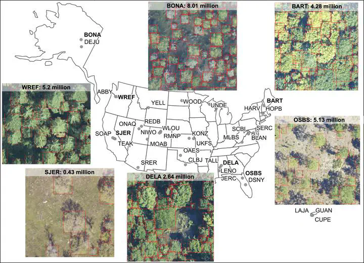
An open-source data set of individual-level crown detections from remote sensing for 100 million trees at 37 sites across the United States surveyed by the National Ecological Observatory Network’s Airborne Observation Platform. Each tree crown is represented by a bounding box and includes information on the height, crown area, and spatial location of the tree.